For a long time I desired to do a solo cycling vacation, just me and my beloved bike. So, taking advantage of an unexpected holiday week, I started looking for a path that was challenging yet rewarding in terms of landscape and nature. My choice has fallen upon on the so-called Friendship Cycle Way, which is the bike route that runs from Munich to Venice across the Alps.
What is it?
The Friendship Cycle Way runs for nearly 600 km through Bavaria, Tyrol, Trentino Alto Adige and Veneto, therefore crossing three countries. The total elevation gain exceeds 3000m and includes three Alpine passes: the Sylvenstein Pass between Germany and Austria, the Brenner Pass between Austria and Italy, and the Cimabanche Pass between Trentino Alto Adige and Veneto. Due to the high elevation gain and the rough surface of many section this path is suitable only for fit or very motivated people.
What kind of bike is it for?
As mentioned above a sturdy bicycle is essential, if not a mountain bike at least a trekking one. This cycle path is absolutely not recommended for city or racing bikes, if you’re not willing to live a miserable experience.I used a self-built mountain bike with an On-One Inbred 29er steel frame and a Salsa Fargo steel fork, Schwalbe Marathon Mondial touring tires, Shimano SLX gearbox and hydraulic disc brakes and obviously a Brooks saddle, faithful companion of many generations of travellers.
How to navigate?
The official guide and the attached map are quite accurate, but to avoid any problems – particularly in the venetian section that is poorly signposted – I suggest you to bring a GPS loaded with GPX/KML tracks. No need to buy a dedicated device, even an Android phone with OruxMaps may be sufficient.
A good number of signs is also scattered along the way, bearing the official blue flag of the cycle path. Unfortunately, in the most hectic sections it’s easy to miss a marker and slip into the wrong path, so the previous advice is useful not to waste precious time and energy.
What equipment do I need?
If you love to travel light as I do, then you don’t need that much. I brought two 15 L Quechua rear bags for carrying clothing, rain gear and food, and a 6 L Decathlon handlebar bag, to be able to quickly release the valuable stuff like ebook reader, camera and smartphone. Under the saddle I hooked a small bag for tools and spare parts. And finally the necessary hidden belt for documents and money. This configuration has proved to be convenient both when cycling and when carried in the hotel rooms.
Where to stay?
The boldest, especially if traveling with a group, will carry tent and sleeping bag, taking advantage of the many campgrounds scattered along the way. To those who’ll choose the solitary path like me, I do not recommend loading all the equipment for sleeping and cooking, opting instead for the more comfortable hotels and B&Bs. This will certainly not be impressive, but at the end of the journey legs and back will thank you.
Being off-season I never struggled to find accomodation day by day with Booking, sometimes even a few minutes before showing up at reception. The prices in mid-June are around 50 € per night for a single room and around 65 € for a double one.
What weather can I expect?
This time I was lucky and I caught a wave of warm and nice weather that did not make me take even a drop of water despite the threatening clouds on several occasions. As you’ll read later I stopped twice not to risk a storm but in retrospect I could have gone on. Average daily temperatures were between 25 and 30 degrees, while nocturnal were between 15 and 20 degrees. After the Alps and the Veneto plains you have to expect a more warm and muggy climate. This was the June situation, for other seasons it could be radically different.
Day 1: Munich – Bad Tolz (62 km)
I reach Monaco from Milan after a quite adventurous overnight journey with Flixbus. The driver’s rude treatment has caused some damage to my bike, mainly to the headset and the fastening of the front bag. Luckily I always have with me my trusty Crank Brothers multi tool, and I can even raise the handlebars for a more relaxed riding position, perfect for such a lengthy tour.
After buying a croissant and a couple of pretzels I head to the river Isar, which will be my travel buddy throughout this first stage. I benefit of the few people around me to wear my official cycling suite and begin to grind the first kilometers. The temperature is cool and the air is fresh, it’s such a perfect sensation! Along the way I meet many cyclists and walkers: there’s a lot of life around here.
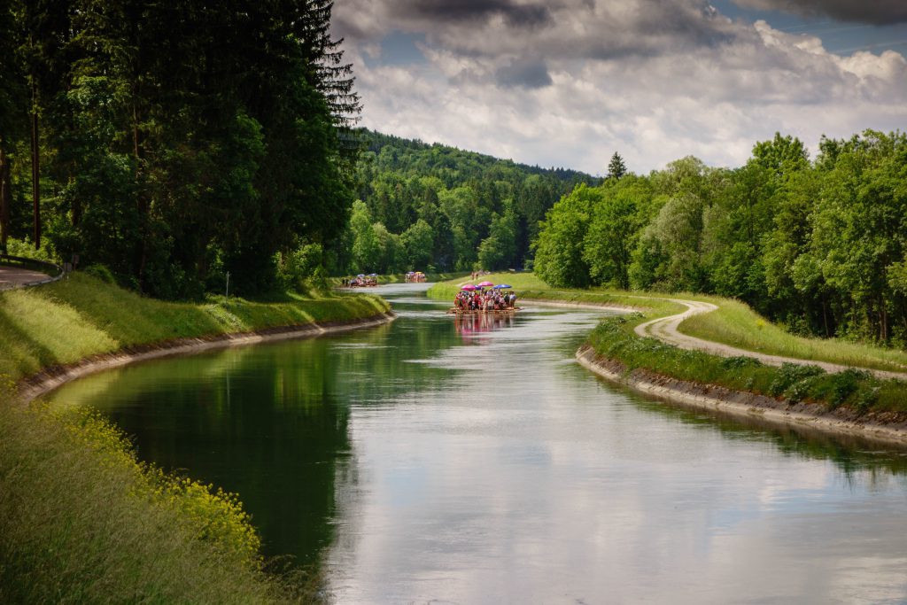
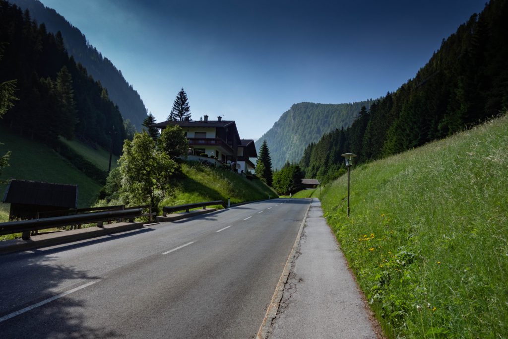
Passing by some unexciting parts of Monaco, the river slowly moves away from the big city, crossing many typical and picturesque Bavarian towns. The most interesting is Waldram, homeport of the rafts that I keep on meeting. People above are all happy and already drunk at ten in the morning, busy playing traditional songs or grilling excellent hot dogs aboard their wooden boats. In spite of all people who think that Germans don’t know how to have fun!
At one point, without any notice, the road ascends with a steep dirt path that leads to a wonderful viewpoint on Isar, with benches to enjoy the breathtaking panorama. Afterwards, an equally steep descent brings me to the bottom of the hill and with a number of quite challenging ups and downs I get to the pleasant town of Bad Tolz. Enough for today!
Concerned to find a shelter for my bike I decide not to reserve on Booking, but to knock directly at the door of some hotels. A friendly lady welcomes me, storing my bike in a garage and handing me the keys of a small yet cozy single room. After washing my cycling clothes and shopping in the town, I lay a frugal dinner in the room before enjoying a well-earned rest. This afternoon I caught a glimpse of the Alps in the distance, and tomorrow I’ll need all the available stamina.
Day 2: Bad Tolz – Jenbach (70 km)
I wake up early, sadly realizing that I’m less fit than I thought. My legs are two pieces of marble and the bottom… well, an utter disaster. After a good continental breakfast I pack my belongings and I’m ready to start again, destination Tyrol.
The first stretch that still follows the Isar river is not particularly tiring, but the commitment significantly increases as I approach the Sylvensteinsee lake at the intersection with the main road on a beautiful panoramic open space, a meeting point for a crowd of motorcyclists.
The route keeps on a short piece of busy road – beware of passing cars – up to Fall, where the real climbing of gravel forest roads starts. I’m not ashamed by having to confess that I got off the saddle many times to push the bike by hands, first of all because my road tires have very little grip on the gravel, but more than everything else because my precarious fitness don’t allow me to do anything else. But, unfortunately, the main difficult has yet to come, because after the climb comes a dizzying descent on rough terrain, followed by other challenging ups and downs.
At one point, crossing the highway again and following it on a parallel path for a few kilometers, I suddenly find myself on the border between Germany and Austria. Just a minute to take the usual photo and chatter with a couple of nice Italian bike travelers, and I have to leave because there’s still so much road ahead and I expect at least a few critical points.
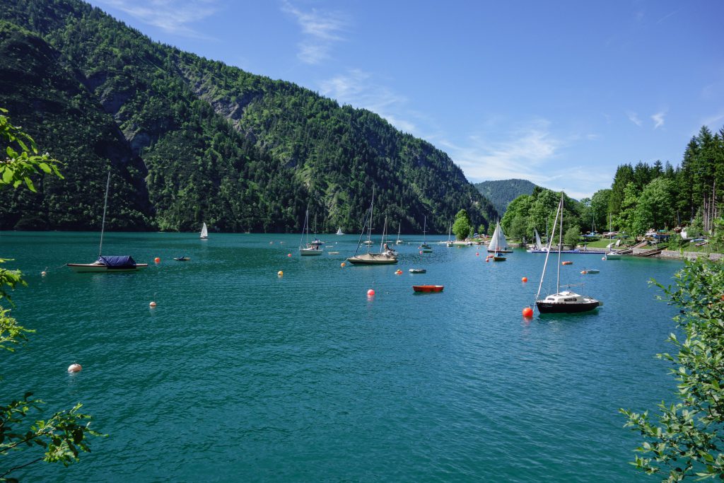
The first is reached shortly after in Achenwald, where the cycle track bends sharply to the left into the woods and climbs on steep dirt road before falling back with wide and fun twists to the valley bottom. I’m finally near the Achensee, that I reach shortly thereafter. I have to admit that his reputation is very well deserved: a beautiful body of water, full of people, activities for children and opportunities to relax. In a day like this it seems that all Tyrol has arranged to meet there. I take this opportunity to make a break on the shore with a smoked sausage and a slice of lemon cheesecake.
The cycle path runs along the lake and it’s a very panoramic stretch, a sort of preparation for the next effort. In fact, right after the southern end of the lake by the city of Maurach, the track rises and then suddenly plunges into a thrilling dirt downhill path. I have to grasp my brakes to avoid losing the bags on the road! My not so knobby tires struggle to bite the ground and at some points I have to stop to regain feeling in my hands. The section is rather long, but looking back now that I’m home safe and sound, also really funny.
When close to Jenbach, more precisely in Wiesing, I use Booking to find an accommodation for the night in the near town of Rofansiedlung that unfortunately can be reached only by another steep climb. But ok, let’s hope it was worth it…
Not even in my wildest dreams I could have imagined something like that. A warm reception similar to that of some distant relative that you haven’t seen for years, a beautiful and comfortable room packed with every imaginable accessory, a natural pool with no other swimmer besides me, and even a margherita pizza delivered to me by the owner during a sunset on the Alps.
What else? Nothing, except that for many days I dreamed of being still there.
Day 3: Jenbach – Steinach (50 km)
I wake up early again, but this time the weather sucks. The sky is overcast and threatening rain at any moment. I’m a bit worried ‘cause today I should climb the Brenner Pass and conditions are less than optimal. Not even the excellent breakfast in this gracious house is able to return me my smile.
I leave with anxiety and try to grind many kilometers as possible. The track follows the Inn river on one of the most famous cycling routes in Europe. Unfortunately, maybe for the dull day or for my eyes still full of yesterday’s magnificence, I can’t manage to enjoy this stretch, so full of ugly industrial warehouses and farms.
My crotch hurts so badly I start to be afraid of having to quit the adventure. Never! I halt in Schwaz for a stop at the local mall, where in addition to a bit of food for the day… I get a zinc oxide tube, commonly known in Italy as Pasta di Fissan, a typical remedy for diaper irritations.
After a generous application I reach Innsbruck in the early afternoon. The weather still sucks, but I decide nevertheless to start dealing with the first section of the climb. Immediately I’m lined up behind a row of smelly trucks and caravans, a few drops start to pour and the saddle is unbearable.
I’m worried and discouraged, and so I take the submissive decision to get to Steinach by train. I buy a ticket for the modest sum of 10 € (!) and leap over a timely and comfortable Austrian railway for a trip lasting a dozen minutes. I’m halfway to the Brenner Pass, and ironically sun is peeping through the clouds. It will be the only non-cycled piece of the entire journey, just about fifteen kilometers, yet it sounds like a small defeat.
I find with a room for the night, as always using Booking, with views above the local cemetery and one of the boldest highway viaducts of Tyrol. The situation is a little bit depressing, and so I decide to find some comfort in food. There’s no nuisance that a nice pork cutlet with french fries, a local pint of beer and a generous slice of strudel can not at least alleviate. So it is, and after a walk at sunset I retire to my room hoping for a better tomorrow.
Day 4: Steinach – Vandoies di Sopra (75 km)
I’m a bit late with the roadmap, and now that my crotch seems to show some signs of improvement I have to recover. But there are still the last 15 km of climb to Brenner. To face them I wake up early and make a heartier breakfast than usual. The choice is good ‘cause there’s little traffic at this hour in the morning. Of course, some cars run and the roadway is not protected, but with some attention the situation is definitely better than yesterday afternoon’s chaos.
Immediately after Steinach the true ascent begins. Some chunks give a little breathing space, but others are really tough and without any break. I’ve also to stop myself in one of the worst points for an ongoing road work. Starting again with such a slope and a fully charged bike is quite a feat.
No matter, because after just over an hour a village appears around a bend and it’s Brenner with its customs border. It looks like a ghost town, with a huge deserted outlet shop, so as the streets and sidewalks. The invasion of migrants to Austria that I had imagined watching the TV news here does not seem to be so critical.
I take home the mandatory pictures under the signpost and start again on the other side. The first part still follows the highway and overcomes some construction going on, and then turns right onto the cycle path of the Isarco Valley. This is definitely one of the most beautiful spots of the entire trip: an exciting paved descent through the moving scenery of Trentino Alto Adige. Enchanting forests, sudden galleries and picturesque mountain villages are nourishment for body and soul.
The cycle route also passes through major centers like Vipiteno. Here I find a town market and buy an excellent venison salami that will allow me later to make a nice snack. After reaching Fortezza and its lake, the road bends sharply to the left to follow the cycle route of the Val Pusteria. The nice downhill unfortunately gives way to a continuous up and down which proves to be more challenging than expected. The passage from Rio di Pusteria, one of the most renowned centers of the valley, allows me to do a little shopping in the local market: canederli (local dumplings), Forst beer and organic Vipiteno yogurt with blueberries. Impossible to find more typical products than that!
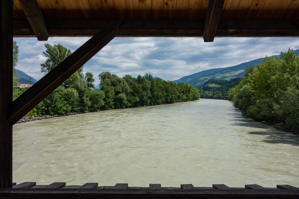
The last kilometers following the Rienza river are tough, and even more when I find out that I have booked the hotel on the other side of the valley, of course with the inevitable last ritual climb. Fortunately, this time it’s a whole apartment with a bathroom and a kitchen. Just enough time for a swim in the outdoor pool, and I’m ready to cook a heavenly dinner. Today the clouds have been eventually wiped out altogether.
Day 5: Vandoies di Sopra – Dobbiaco (50 km)
The day starts with a vast breakfast served by the gracious owner of the house. Today I know I’ll face the fearsome Cimabanche Pass, so I want to start with a moderate advance. I pack up my things and am ready to overcome the last part of Val Pusteria. I get back to the cycling track and right away it starts up with a succession of ups and downs and also some not so trivial uphill. The surroundings are very striking, but in my mind I have only one thought: those dark clouds that are oncoming from the four directions to form a single black sky.
After some annoying raindrops I get in Brunico while some timid ray of sunshine is peeping out. Here, among the many tourists and traffic, I remember why each time I pass through a big city I thrive to get back to my beloved streets secluded in the middle of nowhere. It’s just about noon, but I can’t spend any time to eat. Today I have to hold on and to focus on the goal.
The road bends to the right and for a stretch runs along the placid Rienza river before putting in a dense forest. Here make their appearance a couple of icy tunnels, so cold to force me to get off to wear a sweatshirt before going on. I continue amidst bucolic mountain villages still climbing up to the Valdaora lake. It would even be a beautiful place, between scenic benches and interesting information boards, were it not for the first drops that begin to fall from heaven.
One last valley full of hills and meadows is between me and Dobbiaco. I just have to take a difficult decision: continue to the Cimabanche Pass braving bad weather or surrender for the second time to Jupiter Pluvius, thus ending the day here?
Common sense makes me opt for the latter. I seek a way to book a hotel not too far from the center, and I find it pretty close, but right on the main road. And it’s one of the most difficult moments of the whole trip. The failure to reach the goal of the day, the bad weather conditions, the so-so accommodation… they make me see everything black, and I fall into a mild depression. But after a good shower and a walk in the town center to get some supplies a mocking sun comes out, and I find myself with salmon, berries and a cold beer on the terrace of my room overlooking the Dolomites.
Definitely a great way to end this day that seemed wasted.
Day 6: Dobbiaco – Ponte nell’Alpi (105 km)
The disappointment of yesterday has given way to concern. Now I’m a bit scared of not being able to finish the tour on schedule. Too many kilometers remaining and my legs are becoming increasingly harsh. There are also still two alpine passes to overcome and I’m no longer very confident on the success of the trip. But at least now it’s sunny and I can try.
After a sad breakfast I get back on the track, this time heading towards the path that leads to Cortina d’Ampezzo. Not even a quarter of an hour later I’m already running along the banks of the photogenic Dobbiaco lake, kissed by the morning light. The pleasure doesn’t last long, ‘cause the route begins to climb with a moderate yet noticeable slope.
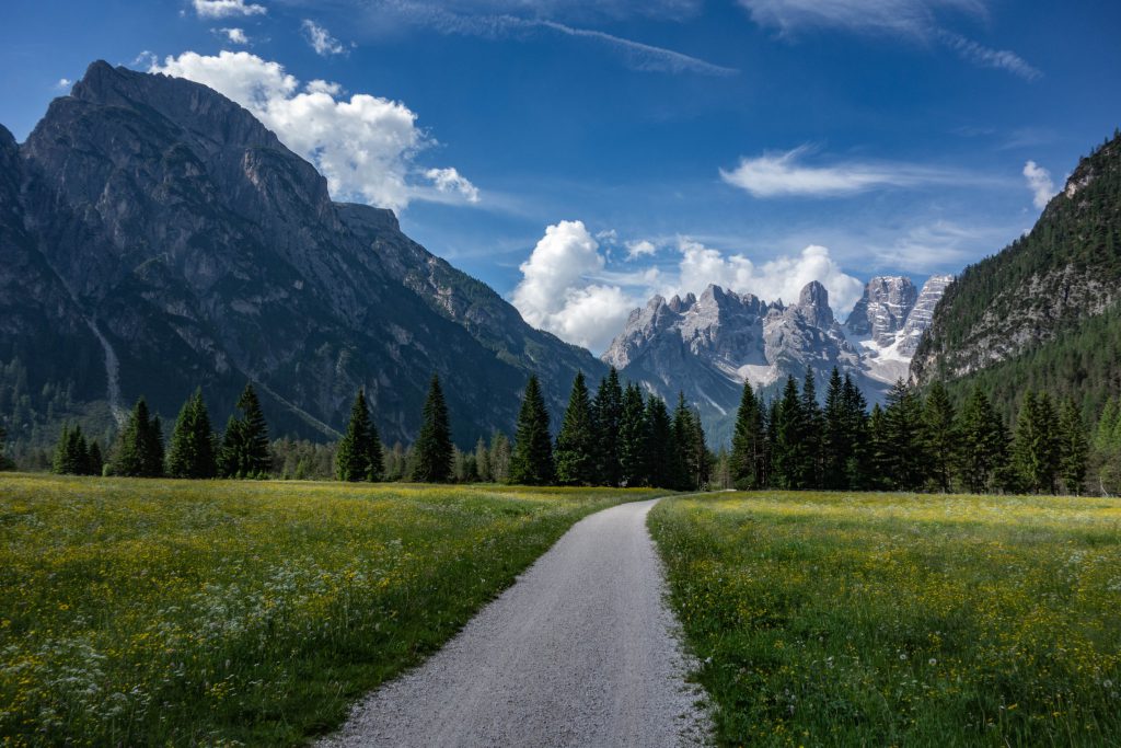
At first it skirts the road with the Dolomites in front, as if you were pedaling through an immense postcard. Suddenly a modern wooden structure appears and on the left you have a great view towards the famous Tre Cime di Lavaredo, although Monte Cristallo is the real king at this juncture.
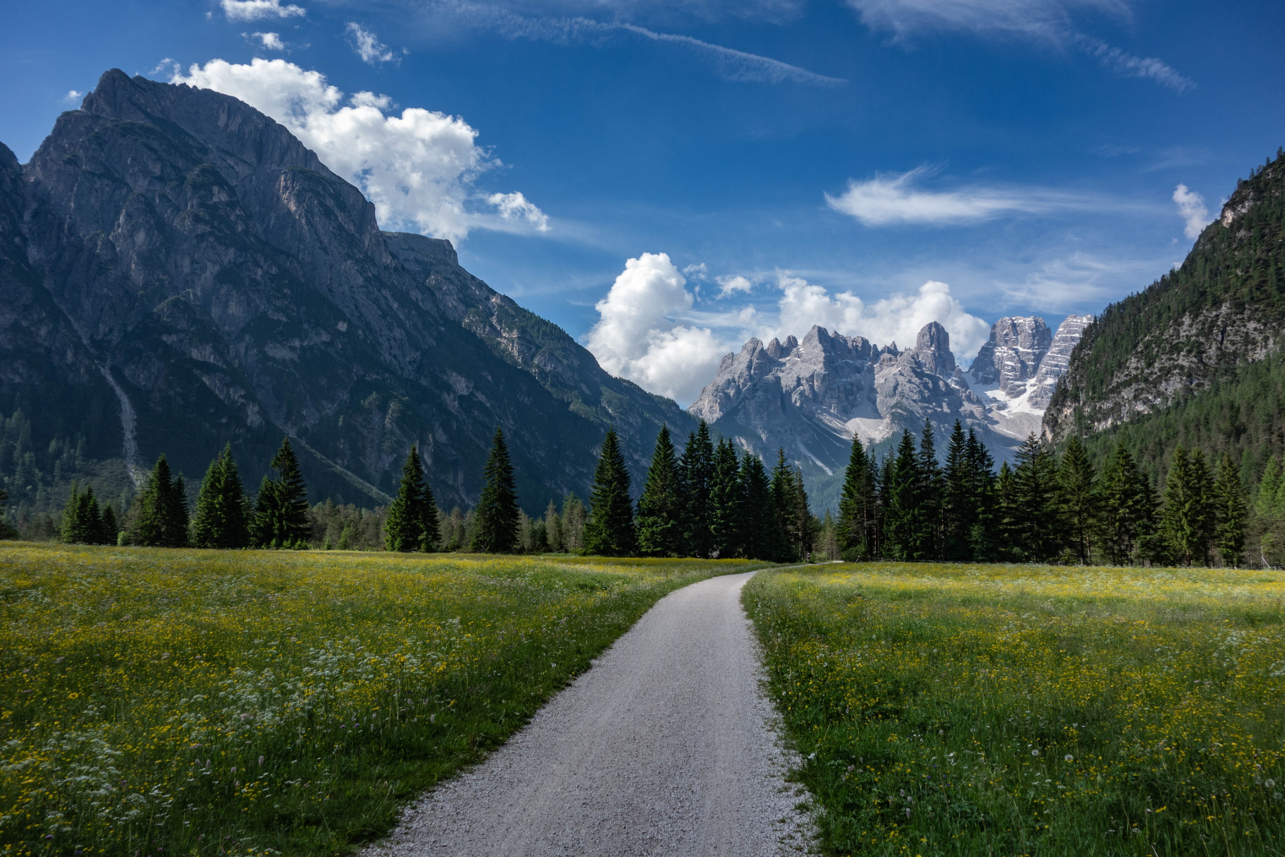
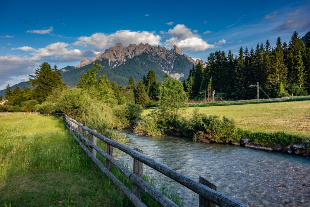
The path gets back in the woods and this time the ascent is significantly greater. Some big rocks have to be crossed carefully, this is a piece to be reckoned with. Fortunately the pass is not far, and so before noon I’m ready to leave Trentino Alto Adige to go downhill in Veneto, not without a tear.
The section I’m going to describe is another highlight of the whole trip. The cycle way, drawn on the old railway track, goes really fast through dense forests with an open view of the entire range of the Dolomiti d’Ampezzo. It’s paved and unpaved, so funny and full of great views that fill my heart of pure happiness and help me find some strength I didn’t think I had.
So after thirty kilometers I reach Cortina, the queen of the valley, who now feels a little nostalgia of its glorious past in hotels that have lived better days and a tourism that seeks to become progressively more accessible. Just a short stop in the center and I get back on the bike for a beautiful descent, admiring the open view over the valley.
I’m now in Cadore and pass through a range of pleasant mountain resorts. Unfortunately the descent often gives way to some rocky hills, which often even force me to go down to push the bike by arms. But they are only short sections that do not detract from the fast loss of altitude pulling me towards the plain. The Alps are now almost a distant memory, and so is the nice atmosphere up there. The heat is a new enemy with which I have to start doing the math.
After Perarolo di Cadore the bike lane ends and I have to take the former Alemagna state road, large and well drawn, but not as deserted as it had been described by the official guide. Indeed, the cars whizzing by me at great speed remind me that Italy is unfortunately a country not yet ready to manage cycle touring. The little towns in this area, now cut off from the new road built on bold viaducts, seem almost deserted were it not for some car parked here and there. I continue on the road with an open eye on the traffic situation and get soon near Longarone, sadly known for the Vajont disaster. The road that goes on the other side of the valley runs right above the stream and looking up at the mountain I can see her still there, the dam, that survived this wave that has brought so much death and devastation.
Discarding the directions for Belluno I keep on pedaling up and down with ascends also quite important, and then abandon the path near Ponte nell’Alpi. Here I stop to take a short shopping before heading to the room that I obviously booked with Booking. Unfortunately, I find that the guest house is again on a hill and I have a devastating final climb before I can put the end word to this endless day.
With over one hundred kilometers subtracted from the total I can now hope I can get to Venice in two days. After a hot shower and a frugal dinner, I fall into a well deserved rest.
Day 7: Ponte nell’Alpi – Treviso (100 km)
The B&B owners treat me like I was their own child, and so I start the day with a splendid breakfast full of cakes and homemade jams. A real pleasure! It’s really hot, there will now be to sweat hard, and not just metaphorically.
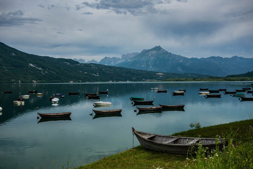
I put my crotch on the saddle and get back to join the route, sometimes dirt, which leads to the Santa Croce lake. This placid and relaxed place manages to offer my eyes, orphaned by the grandeur of the days before, a spark of beauty.
At the height of Farra d’Alpago, to my great joy, I get back again on the state road Alemagna, again featured by the annoying traffic. I get through some uphill tunnels up to conquer the Sella Fadalto pass which marks the border between the provinces of Belluno and Treviso. Then the road goes down the other side of the hill, and I have to be careful to carve out my space between cars and motorcycles. In Veneto unfortunately they really forgot to build the bike path.
I pass through a number of cities, including Vittorio Veneto. They’re not so interesting and also also quite chaotic. I don’t want to overstate, but this part of the trail is really really bad: I have to overcome countless hills with significant slopes – up to 10/15% – often passing close to the motorway and other fast roads. I have nothing to add about the last stretch that leads to Treviso, if not that doing that without GPS would surely lead to get lost in this maze of streets and alleys between cultivated fields, farms and vineyards.
The arrival in Treviso, with its beautiful entrance doors and the river Sile, returns a little interest in this very dull and unnecessarily tiring day. I decide to stop here, I could maybe go on and complete the trip today, but I want to enjoy an easy arrival in Venice.
I find a hotel downtown that can keep my trusty steed for the night, I wash and get ready for a quick tour of the beautiful city. Tonight I can have a hamburger with fries, beer and a nice view of Piazza dei Signori. It doesn’t seem true, but I fluctuate between satisfaction and a bit of melancholy to be so close to the end of the adventure.
Day 8: Treviso – Venezia (50 km)
Let’s face it: if it were not for the pleasure of completing the trip, this Venetian stretch could be skipped in its entirety. But now I’m so close to the goal that I just have to bite the bullet and finish what I started one week ago.
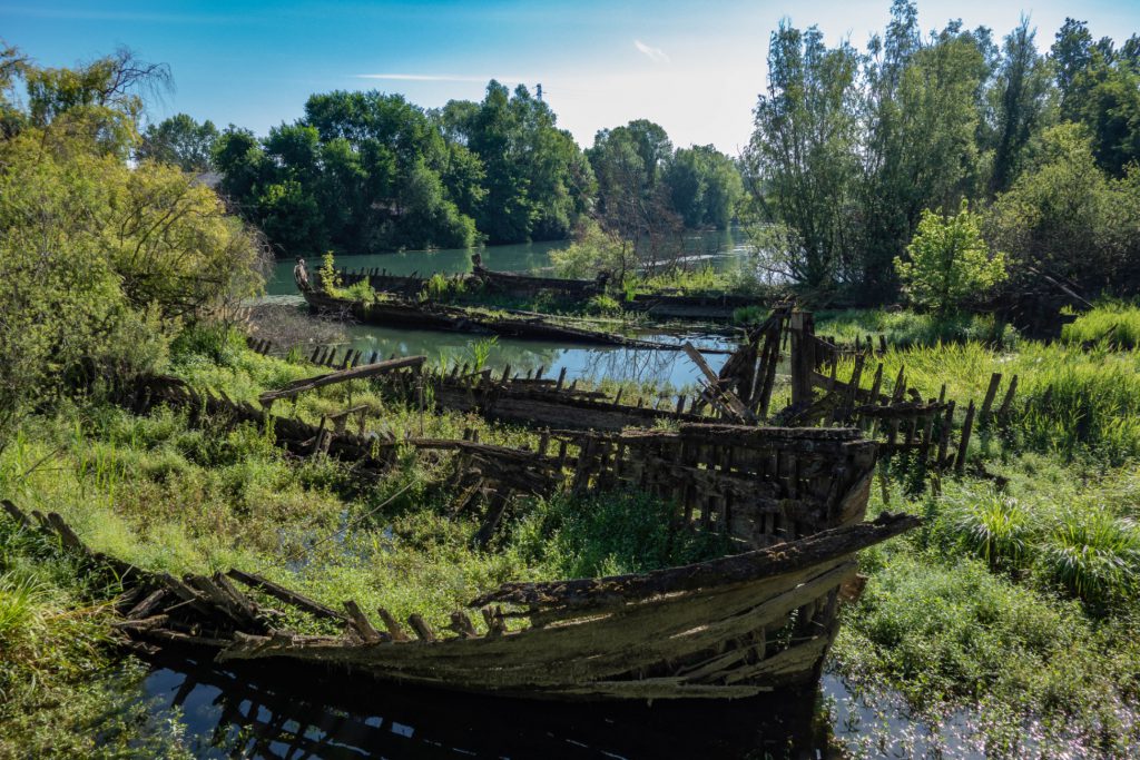
Just enough time to make a hearty breakfast and I’m ready to get along the riverloops of the Sile, including some boardwalks, wetlands and the charming Cimitero dei Burci where the typical local boats were sunk in the seventies in protest against the advent of the road transportation.
The path is more difficult than I expected, and has also many rather uneven dirt sections. The area is very lively, and I pass by factories, furnaces, and several skeletons of now disappeared activities.
I’m now again in the countryside, and at times I can already feel the smell of the sea. I lose the road repeatedly, but with the help of my GPS I can always find some more or less viable alternative. Going zigzag little paths I reach Mestre, for a final beautiful bike path up to the city station.
My aim would be to go to Venice, but between fatigue, the fact that I’ve already seen the town a thousand times, and with bicycle transport train leaving in a few minutes I decide to stop here my tour. I climb on the “cattle train” to Milan, with the perception of having lived one of the most exhilarating experiences of my entire life. I suffered, sweared, sweated, rejoiced, but most of all I have lived! If you still have any doubt I can tell you that if you love adventure and hard work this is absolutely an experience not to be missed!
Lascia un commento